Show Notes
At RK&K, we go above and beyond to earn and keep our clients’ trust. That principle is why the City of Virginia Beach hand-requested our team to create a stormwater master plan (SWMP) for the Upper North Landing River – which includes one of the largest and most complex basins in the city.
Despite not having a master planning contract in place, Project Manager Rachel Friend, PE, CSM said the city knew our work and past experiences spoke for themselves.
“They’ve been really impressed with what we’ve come up with,” Rachel said. “So, they just came to us and asked us to do it. It wasn’t something that we pursued.”
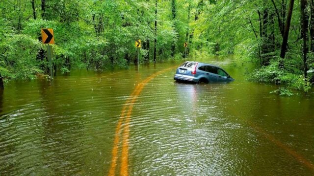
Extreme flooding often plagues the Upper North Landing River project site, requiring a stormwater master plan.
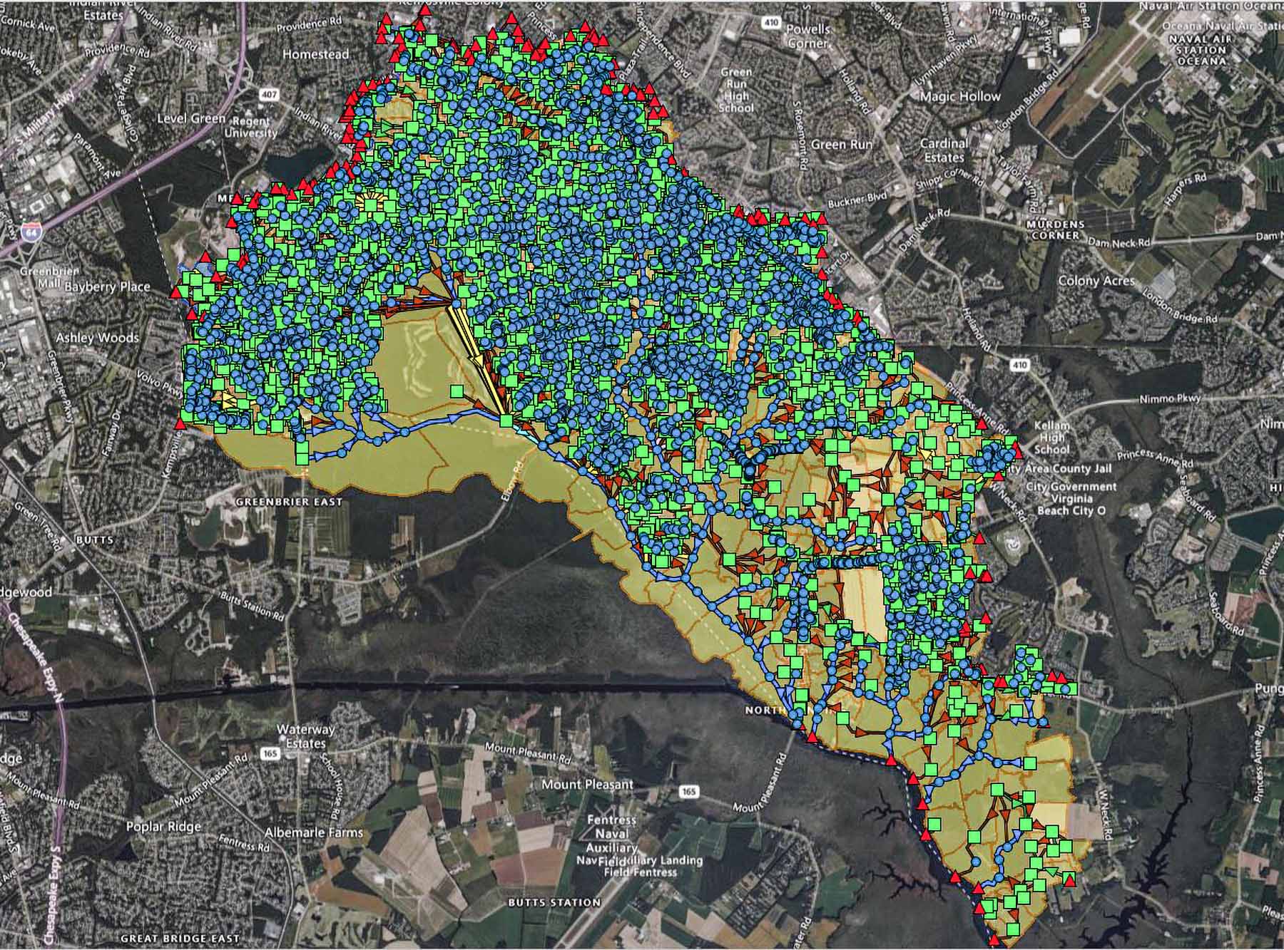
The Water Resources Environmental team has been tasked with finding solutions to flooding issues in many of the city’s watersheds. The Upper North Landing River area includes 156.84 miles of pipes and 61.89 miles of open conveyance system. There are a total of 7,071 nodes and a drainage basin area of 30.5 square miles.
From the city’s existing conditions model, the team has identified 358 simulated flood areas (SFAs) that require resolution. They are in areas like road crossings and throughout neighborhoods around Stumpy Lake. Rachel said many of these watersheds they identified are interconnected.
The team used lidar and geo-graphic information systems to measure the extent, duration, and depth of flooding.
“Historically, I would say it was more than likely a wetland area that they developed,” Rachel said. “But obviously with future conditions, it’s just going to get worse.”
Utilizing technology like the advanced modeling software PCSWMM, the team can simulate where there is flooding in the area and use LiDAR and geographic information systems to measure the extent, duration, and depth. The result is a two-dimensional model simulated using a one-dimensional model – a technique Rachel said has been cost-effective for the city.
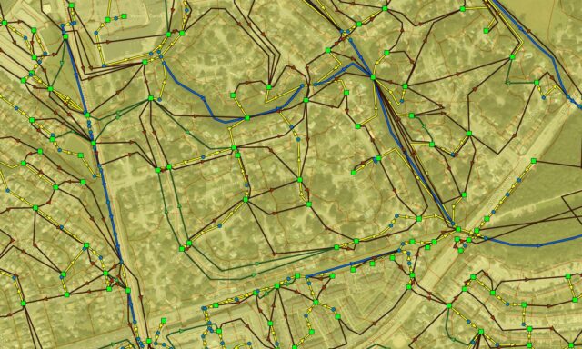
The advanced modeling software PCSWMM was used to create cost-effective models of the site.
The goal is to have roads passable during a 100-year storm event and to reduce the flooding to a passable depth for emergency vehicles.
To account for future conditions, the team is factoring in sea level rise of either a foot and a half, or three feet if an area is considered critical infrastructure. The team is also considering increased rainfall depths, which Rachel said accounts for around 20% more rainfall than what has been historically recorded. Existing tail water conditions in addition to increased rainfall required creative thinking when it comes to modeling.
“This is a pretty challenging watershed because it’s so flat, so low,” said Rachel. “Before it even starts raining [in the simulation], it’s already like, ‘Oh yeah, we’re already underwater by a couple of feet.’”
Innovative solutions, like installing gates in the middle of channels and large pump stations to reduce the flood level prior to storming events, are less costly and more effective ways to combat the issue.
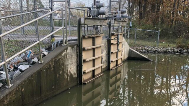
Backflow prevention at the Rosemont pump station.
Because the city has vowed to have the entire city remodeled with a flood relief plan in place by the end of 2024 or the beginning of 2025, an aggressive schedule is required to meet the task at hand. Since receiving notice to proceed last October, the team was given six months to complete the analysis, submitting an average of 40 simulated flooding improvements every two weeks. The usual schedule involves sending around 15 in that time, Rachel said.
To meet these demands, collaboration is key. 13 modelers from five regional offices – Virginia Beach, Richmond, Baltimore, Raleigh, and Columbia – have joined the effort, assisted by support staff who will put together the final report to be sent to the city once modeling is complete.
“I think this level of modeling experience is new,” Rachel said. “So, it’s kind of cool to get others involved and engaged in that and really come together as a team and a group to deliver this project but also to help strengthen RK&K’s skill set.”
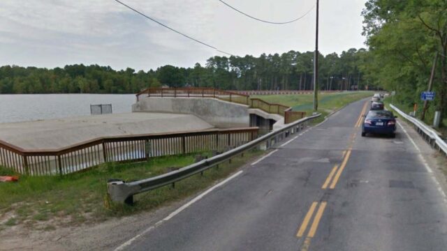
The Stumpy Lake spillway.
RK&K’s work on the Upper North Landing SWMP will help the City of Virginia Beach identify Capital Improvement Projects (CIP), which will be scored and ranked across other watersheds. They will search for other projects to incorporate into their CIP plans and eventually move forward with construction. This “unique” project opens the door for potential future contracts across Hampton Roads.
“All of the municipalities are looking to start following suit with what Virginia Beach is doing with the analysis of the sea level rise, the increase in rainfall depths,” Rachel said. “So, we’re really developing these skills and becoming experts at it to set us up for other municipalities.”
 [JPG, 375.15 KB]