
The Project
For this program dynamics, drivers and mitigation of submerged aquatic vegetation (SAV) and shoreline change – data needs associated with the Mid-Currituck Bridge, RK&K is assisting expanding data collection near the bridge corridor and developing a predictive model of waves and currents to be used as a predictive tool post construction. The project will further develop the SAV mitigation tool by collecting the necessary higher resolution data (shoreline position, bathymetry, SAV presence, proximity to existing vegetation, water quality/clarity) to focus future SAV mitigation sites.
RK&K has significant experience working NCDOT and collecting data in Currituck Sound. RK&K will support this program through the following objectives:
Water Quality: Quantify temporal and spatial changes in water quality, specifically CDOM abundance in surface waters of northern Currituck Sound (Phase 1) and synthesize remote sensing and field data to provide information to limit impacts to water quality, SAV and shorelines during bridge construction and maintenance and to prioritize mitigation for maximum benefit (Phase 2).
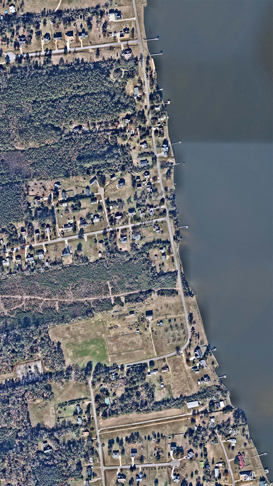
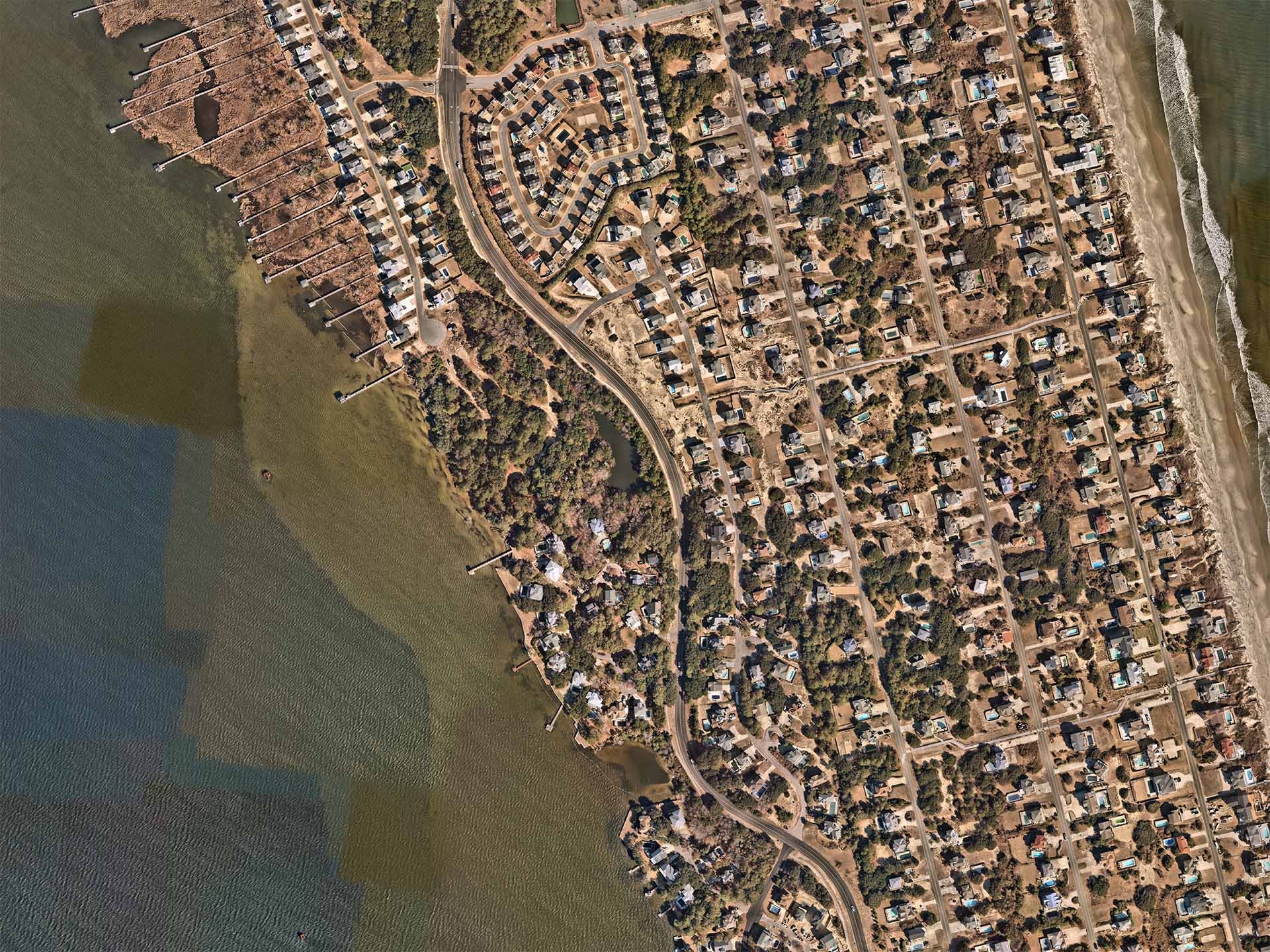
Shorelines & SAV: Evaluate shoreline change rates on multiple timescales, including influence of storms, near bridge landing (Phase 1). Conduct SAV surveys, particularly focused on hotspots of water quality change to identify areas of at risk SAV as well as areas where water quality conditions may promote natural or mitigation-driven expansion (Phase 2).
For both Phases, RK&K’s tasks include establishing erosion rate conditions of the site comparing current imagery with historical aerial imagery; collecting sinuosity and slope at either shoreline; and assisting ECU with quarterly reports and the final report provided to NCDOT.
For this program dynamics, drivers and mitigation of submerged aquatic vegetation (SAV) and shoreline change – data needs associated with the Mid-Currituck Bridge, RK&K is assisting expanding data collection near the bridge corridor and developing a predictive model of waves and currents to be used as a predictive tool post construction. The project will further develop the SAV mitigation tool by collecting the necessary higher resolution data (shoreline position, bathymetry, SAV presence, proximity to existing vegetation, water quality/clarity) to focus future SAV mitigation sites.
RK&K has significant experience working NCDOT and collecting data in Currituck Sound. RK&K will support this program through the following objectives:
Water Quality: Quantify temporal and spatial changes in water quality, specifically CDOM abundance in surface waters of northern Currituck Sound (Phase 1) and synthesize remote sensing and field data to provide information to limit impacts to water quality, SAV and shorelines during bridge construction and maintenance and to prioritize mitigation for maximum benefit (Phase 2).
Shorelines & SAV: Evaluate shoreline change rates on multiple timescales, including influence of storms, near bridge landing (Phase 1). Conduct SAV surveys, particularly focused on hotspots of water quality change to identify areas of at risk SAV as well as areas where water quality conditions may promote natural or mitigation-driven expansion (Phase 2).
For both Phases, RK&K’s tasks include establishing erosion rate conditions of the site comparing current imagery with historical aerial imagery; collecting sinuosity and slope at either shoreline; and assisting ECU with quarterly reports and the final report provided to NCDOT.
Client
Market
- Education