
Director, Healthy Communities:
Melissa Miklus
The Project
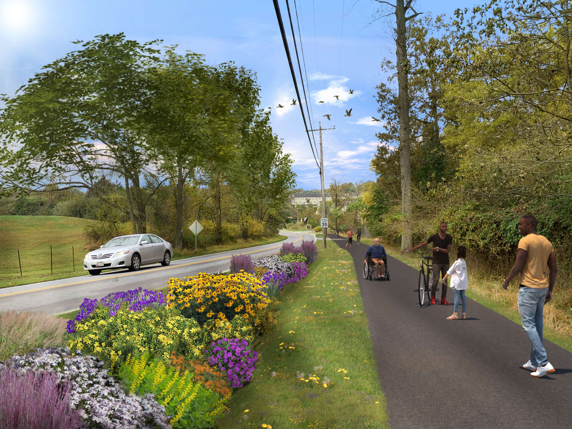
The Patapsco Regional Greenway, when complete, will span over 40 miles traversing the hills of central Maryland in Sykesville to Baltimore’s Inner Harbor. Baltimore Metropolitan Council is taking the lead to explore the feasibility of creating this link across the state and produce 30% design documents to set the stage for further design and construction.
The Healthy Communities team explored the segment from downtown Sykesville, through Freedom Park, and through Patapsco State Park to the McKeldin Area. This segment will include on-street and off-street facilities between the downtown Sykesville Historic District and Freedom Park and a single-track trail from Freedom Park to the Patapsco Valley State Park McKeldin Area.
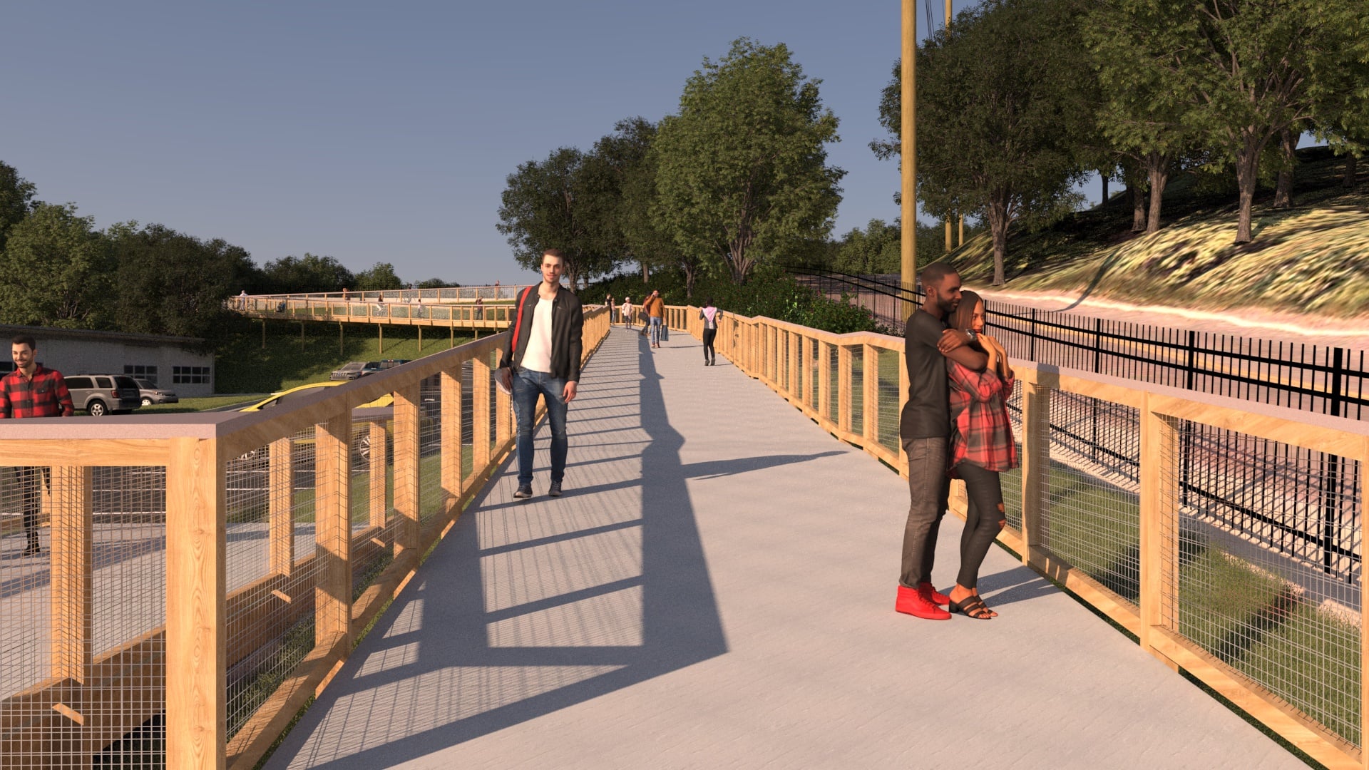
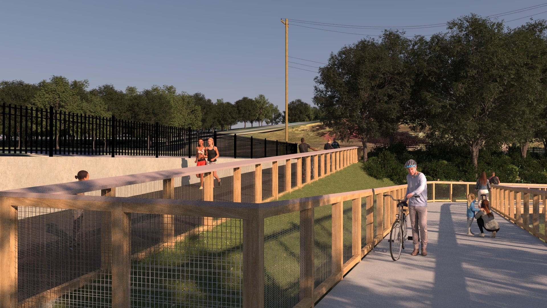
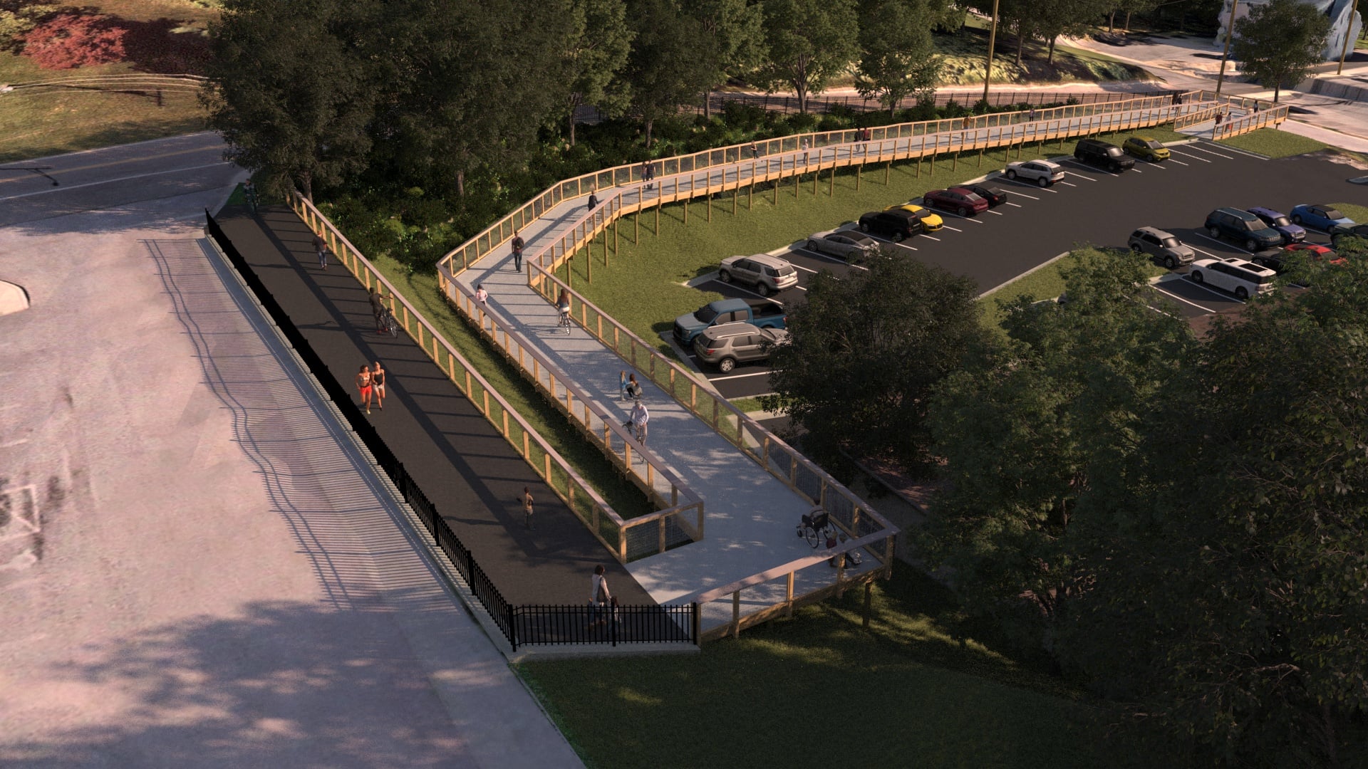
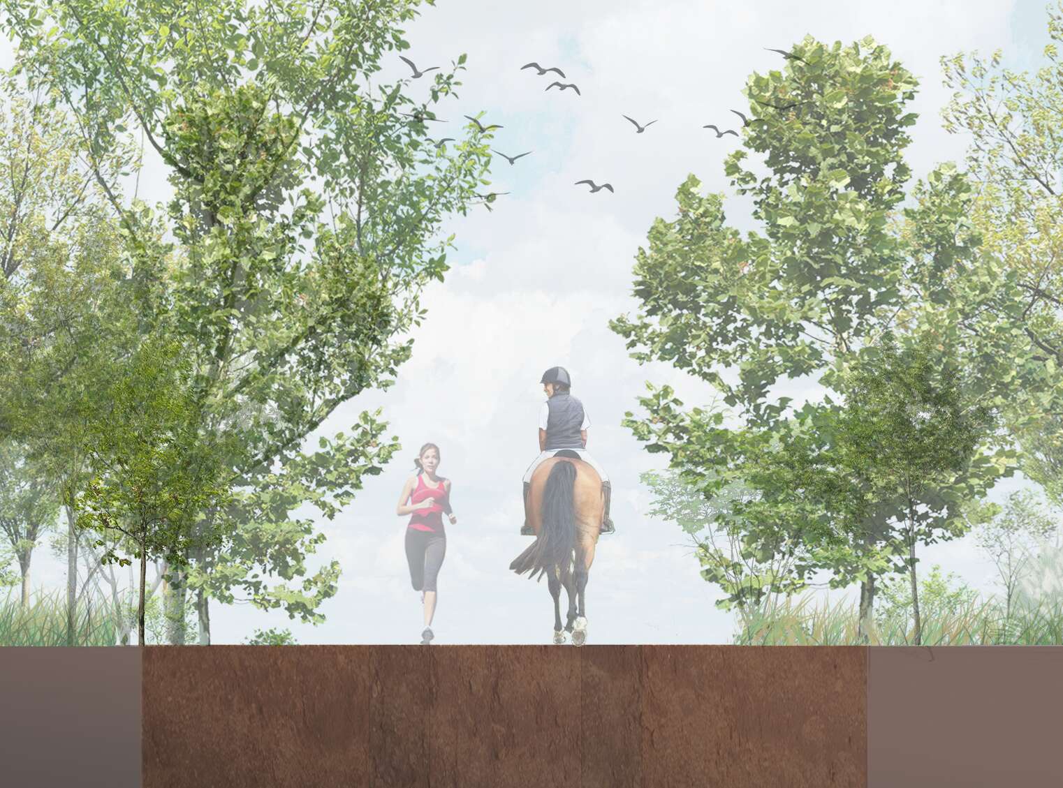
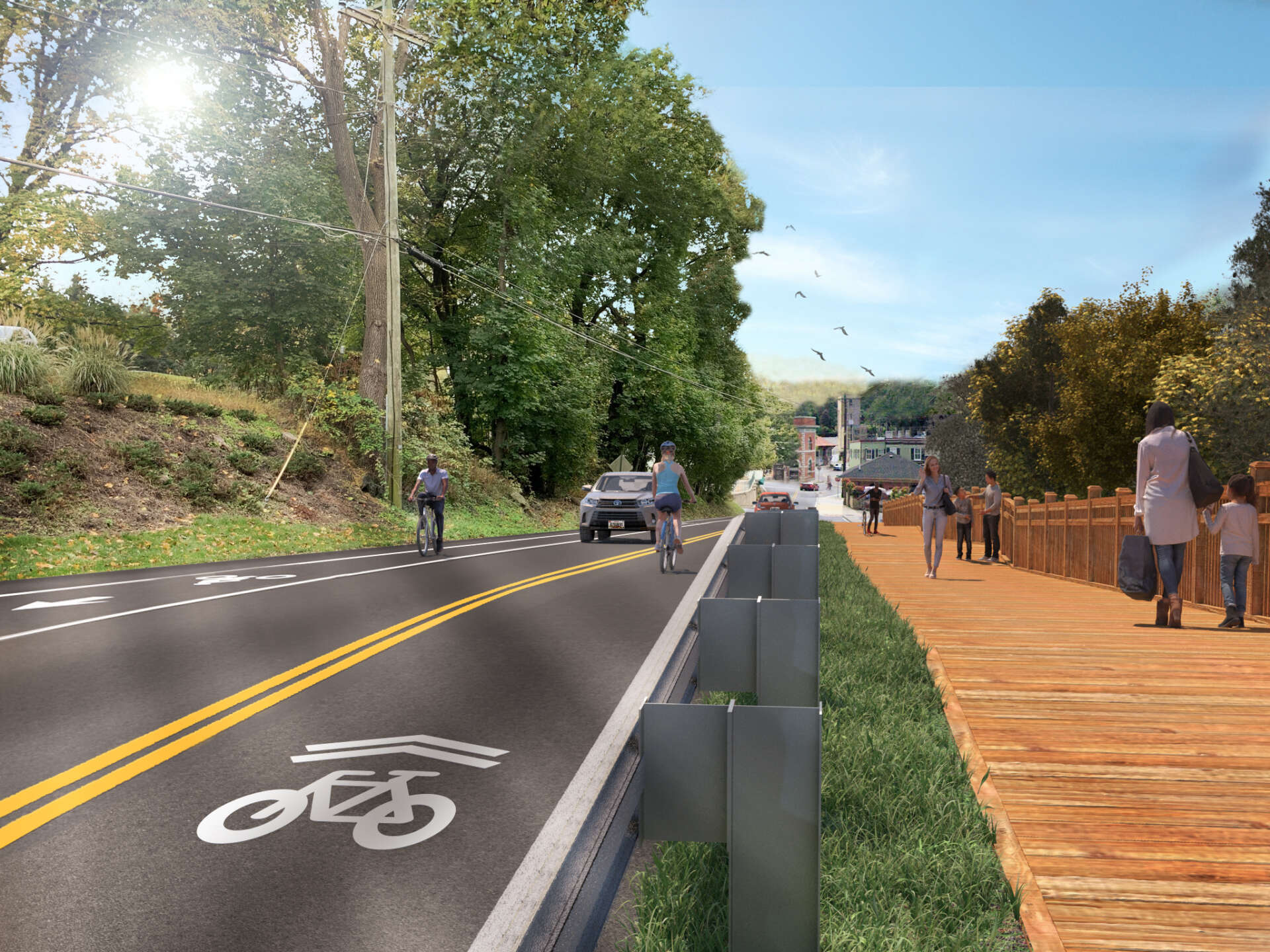
RK&K evaluated a range of facilities in the historic district, developing an evaluation matrix to assess each of the alignment options available from Main Street Sykesville to Freedom Park. Safety, comfort, noise, slopes, separation from vehicular traffic, natural resource impacts, and ROW/parcel impacts were included in the matrix. A field walk was led with the Steering Committee to experience each of the alignment options. Facility types included in the downtown options include sidewalks, shared use paths, on-street bike lanes, and separated bike lanes. Our team also evaluated retaining walls and boardwalk options along Sandosky Road to traverse steep slopes within a very limited right-of-way. Connecting Freedom Park to the McKeldin Area involved determining how to navigate several drainage crossings, challenging terrain, hunting areas, an equestrian club, agricultural lands, and archaeological sites.
The preliminary study also included connections to existing trails and evaluation of a potential 90-foot trail bridge crossing of the Patapsco River to connect with the Henryton Trail in Howard County. Preliminary design services included surveys, environmental assessments, geotechnical investigation, and preliminary design of bicycle/pedestrian facilities, trail alignments, typical sections, road improvements, storm drainage, stormwater management, and streetscaping enhancements.
A significant public outreach program was led, including the development of ESRI Story Maps, the use of Publicinput.com, and virtual meetings to connect with the Town of Sykesville, Carroll County, MDOT SHA, Maryland Historical Trust (MHT), Maryland Department of Natural Resources (MD DNR), Maryland Department of the Environment (MDE) and the USACE.
The Patapsco Regional Greenway, when complete, will span over 40 miles traversing the hills of central Maryland in Sykesville to Baltimore’s Inner Harbor. Baltimore Metropolitan Council is taking the lead to explore the feasibility of creating this link across the state and produce 30% design documents to set the stage for further design and construction.
The Healthy Communities team explored the segment from downtown Sykesville, through Freedom Park, and through Patapsco State Park to the McKeldin Area. This segment will include on-street and off-street facilities between the downtown Sykesville Historic District and Freedom Park and a single-track trail from Freedom Park to the Patapsco Valley State Park McKeldin Area.
RK&K evaluated a range of facilities in the historic district, developing an evaluation matrix to assess each of the alignment options available from Main Street Sykesville to Freedom Park. Safety, comfort, noise, slopes, separation from vehicular traffic, natural resource impacts, and ROW/parcel impacts were included in the matrix. A field walk was led with the Steering Committee to experience each of the alignment options. Facility types included in the downtown options include sidewalks, shared use paths, on-street bike lanes, and separated bike lanes. Our team also evaluated retaining walls and boardwalk options along Sandosky Road to traverse steep slopes within a very limited right-of-way. Connecting Freedom Park to the McKeldin Area involved determining how to navigate several drainage crossings, challenging terrain, hunting areas, an equestrian club, agricultural lands, and archaeological sites.
The preliminary study also included connections to existing trails and evaluation of a potential 90-foot trail bridge crossing of the Patapsco River to connect with the Henryton Trail in Howard County. Preliminary design services included surveys, environmental assessments, geotechnical investigation, and preliminary design of bicycle/pedestrian facilities, trail alignments, typical sections, road improvements, storm drainage, stormwater management, and streetscaping enhancements.
A significant public outreach program was led, including the development of ESRI Story Maps, the use of Publicinput.com, and virtual meetings to connect with the Town of Sykesville, Carroll County, MDOT SHA, Maryland Historical Trust (MHT), Maryland Department of Natural Resources (MD DNR), Maryland Department of the Environment (MDE) and the USACE.
Market
- Recreation
You might also be interested in:
Blog