
Project Value
Director:
Greg Goins
The Project
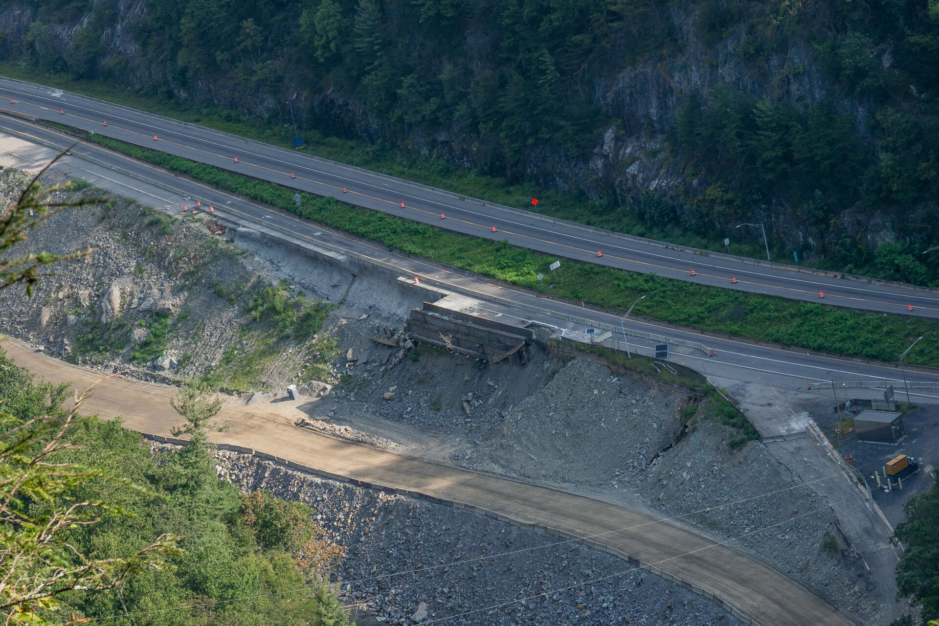
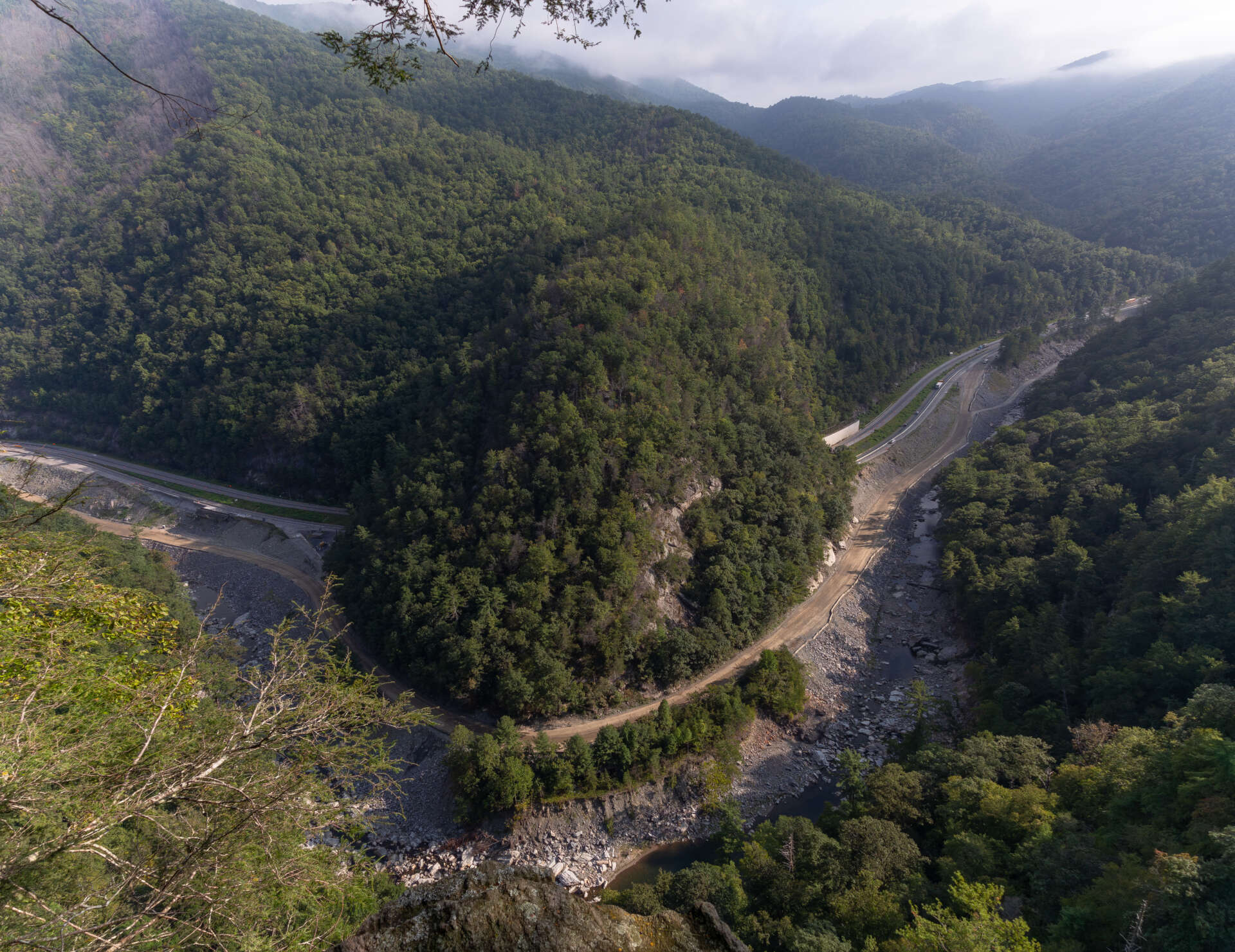
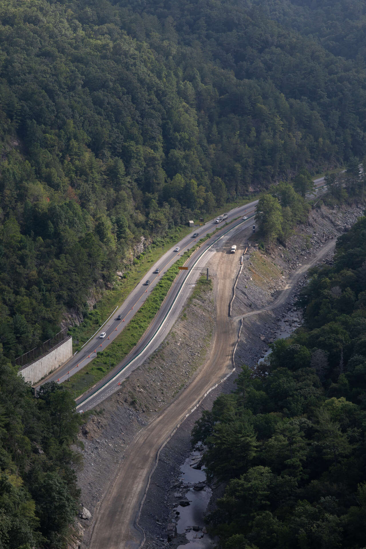
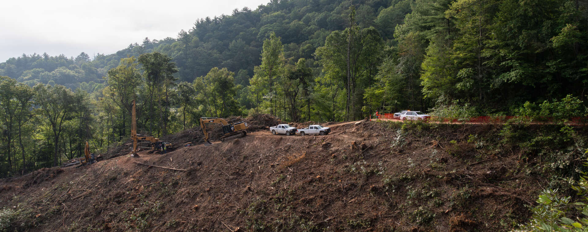
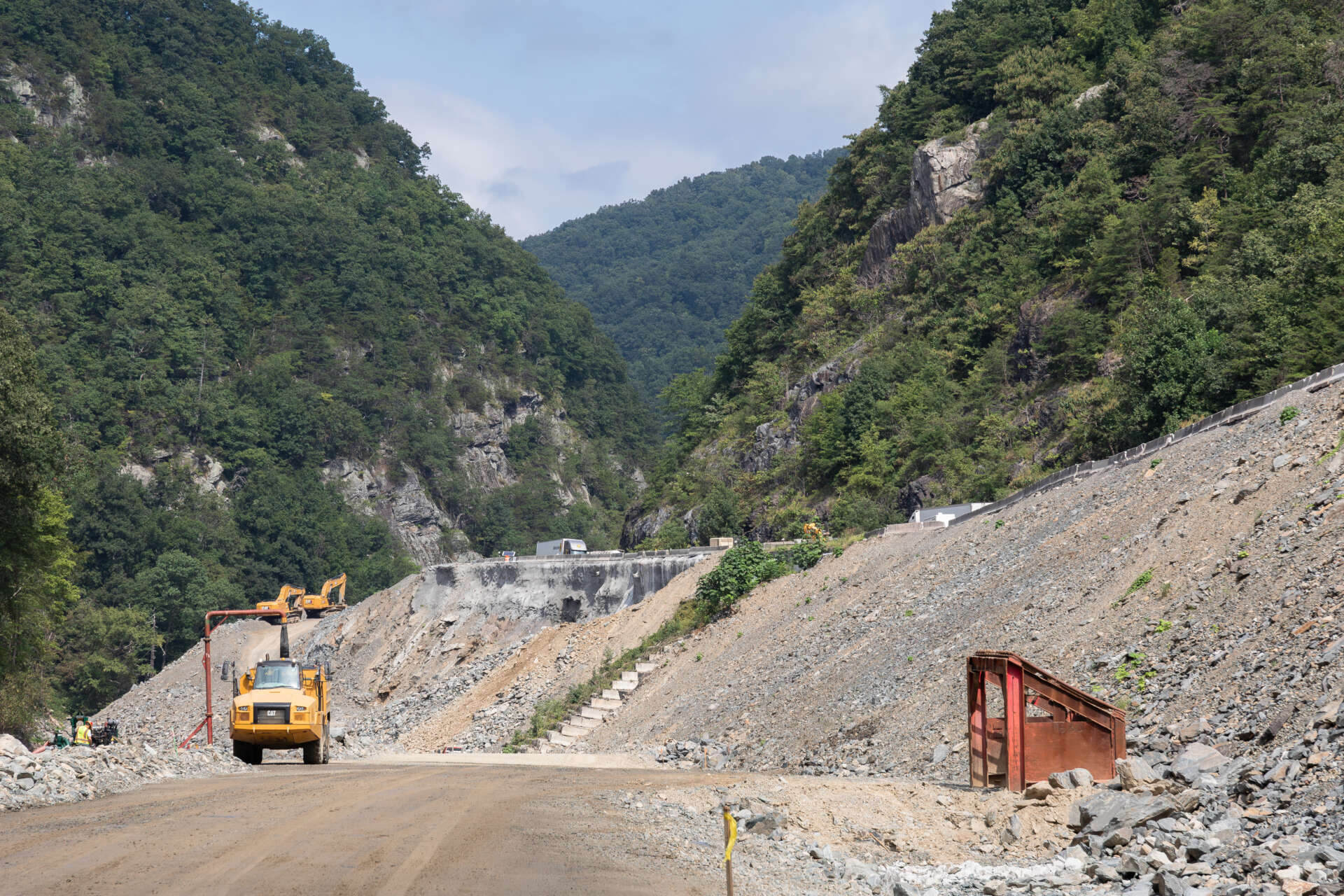
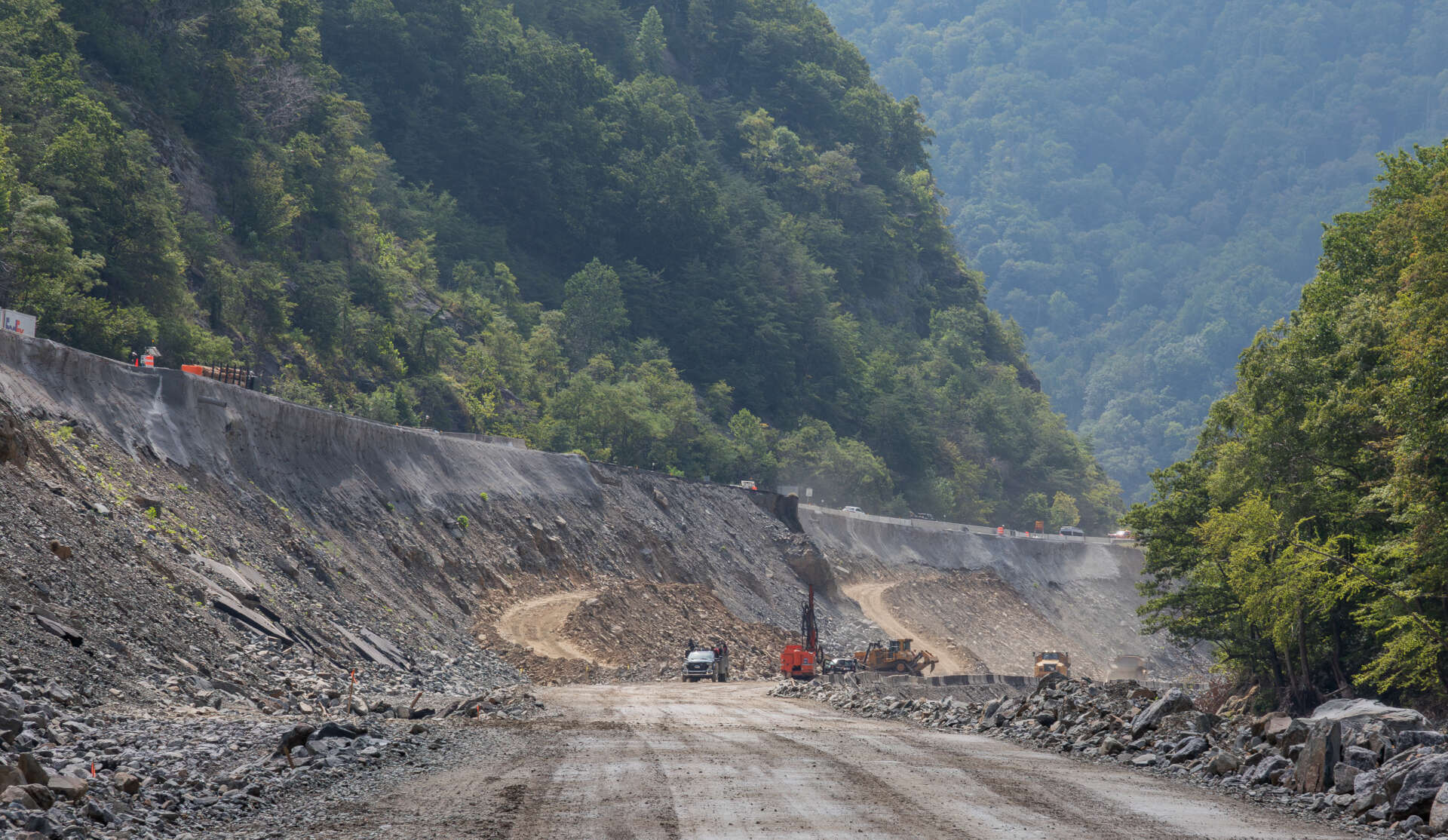
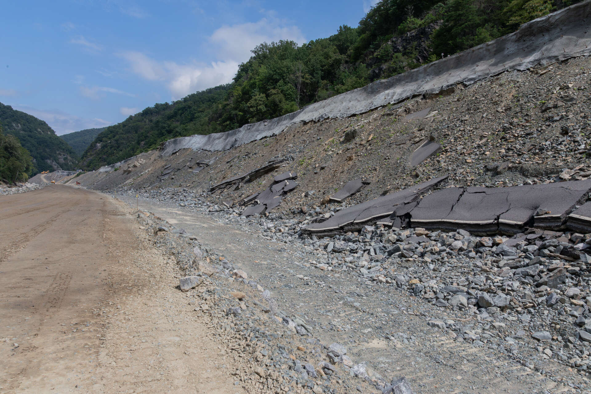
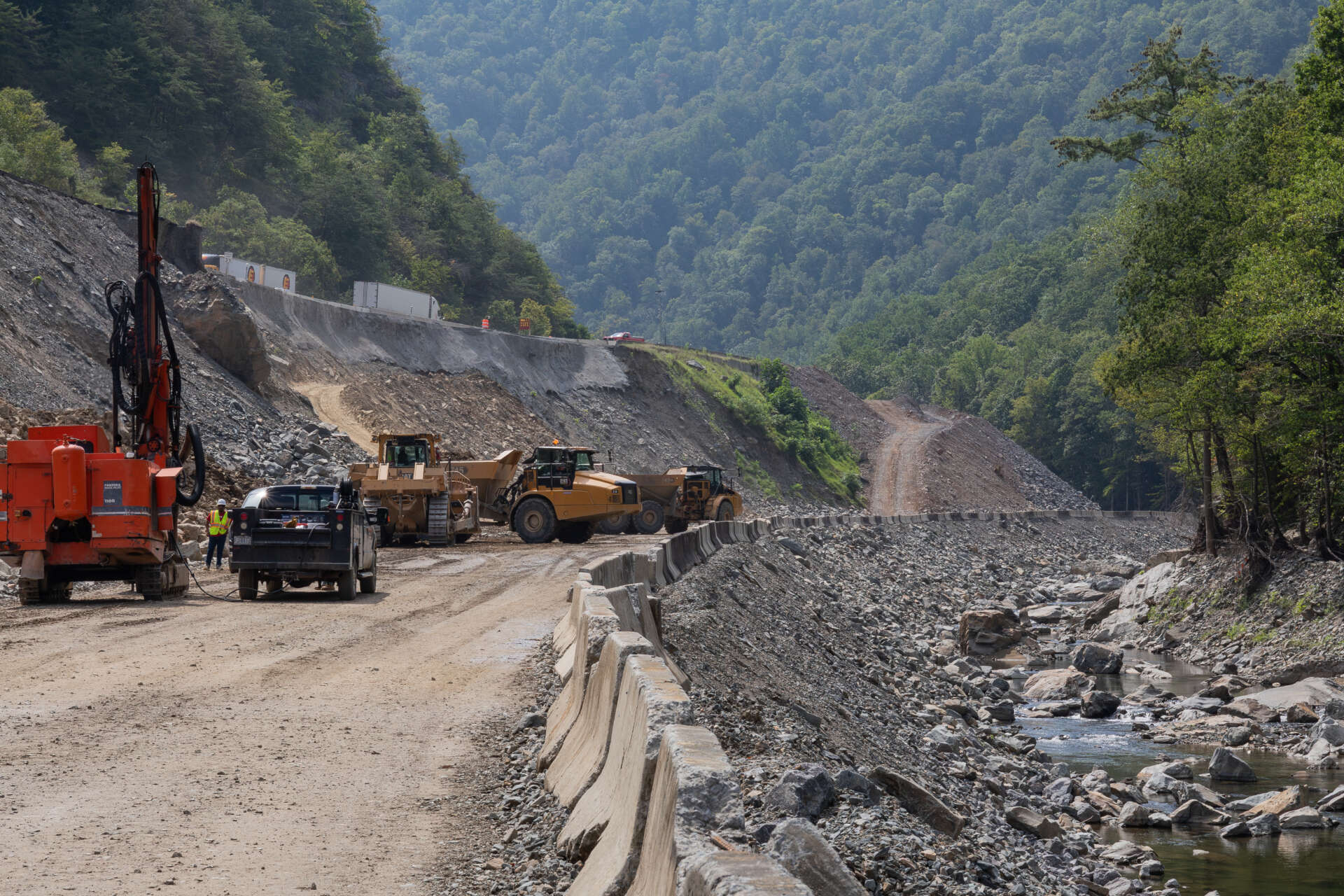
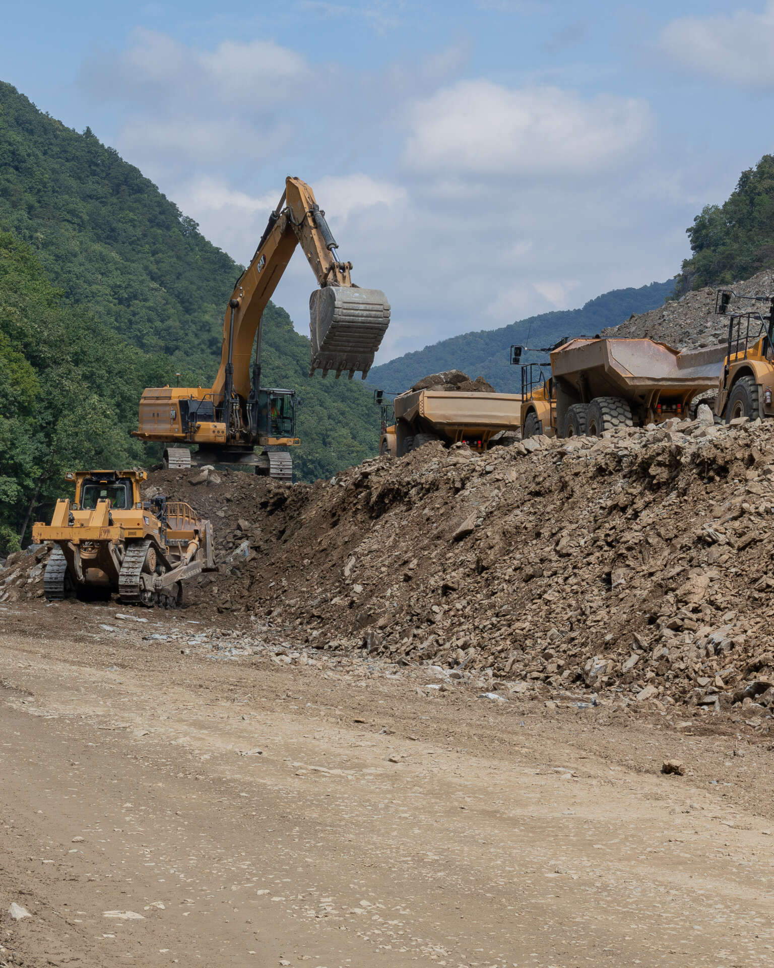
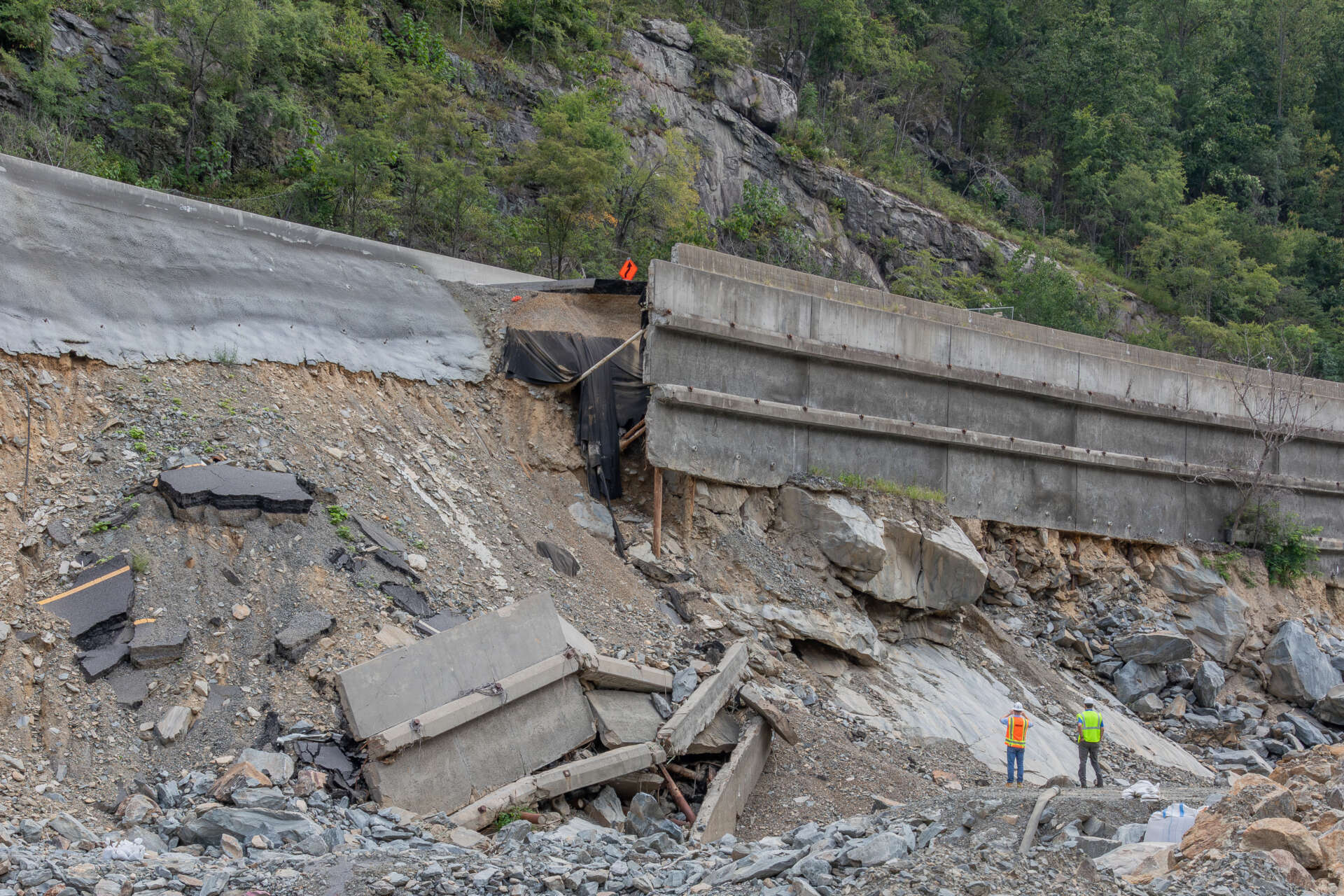
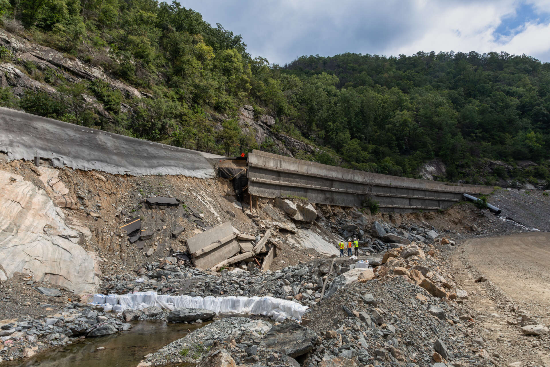
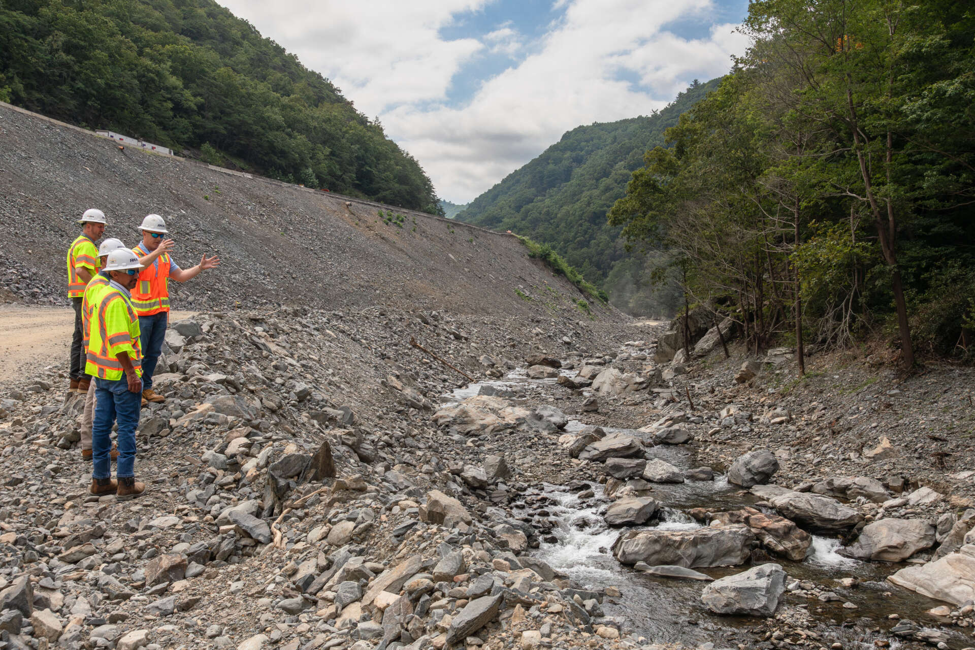
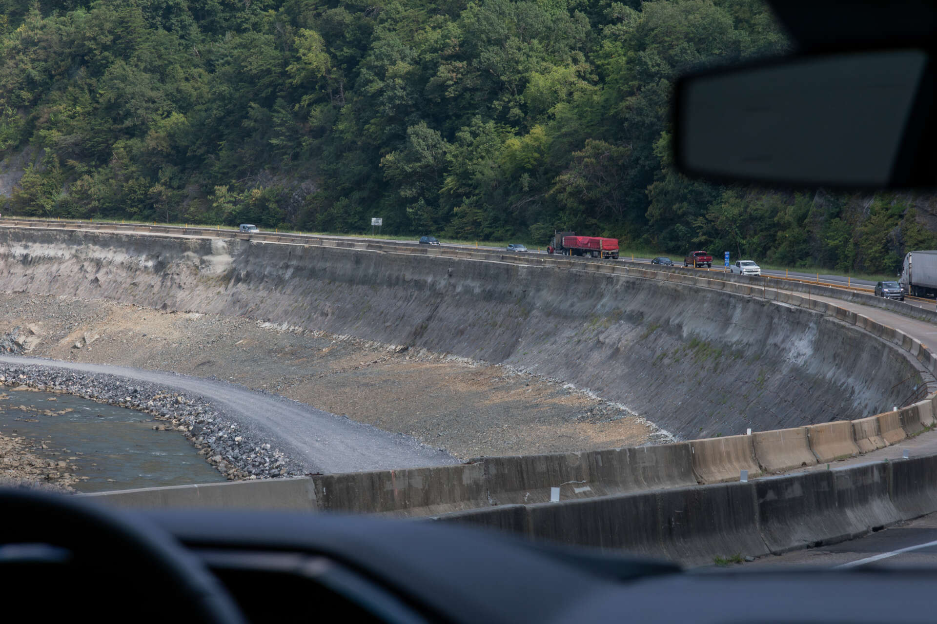
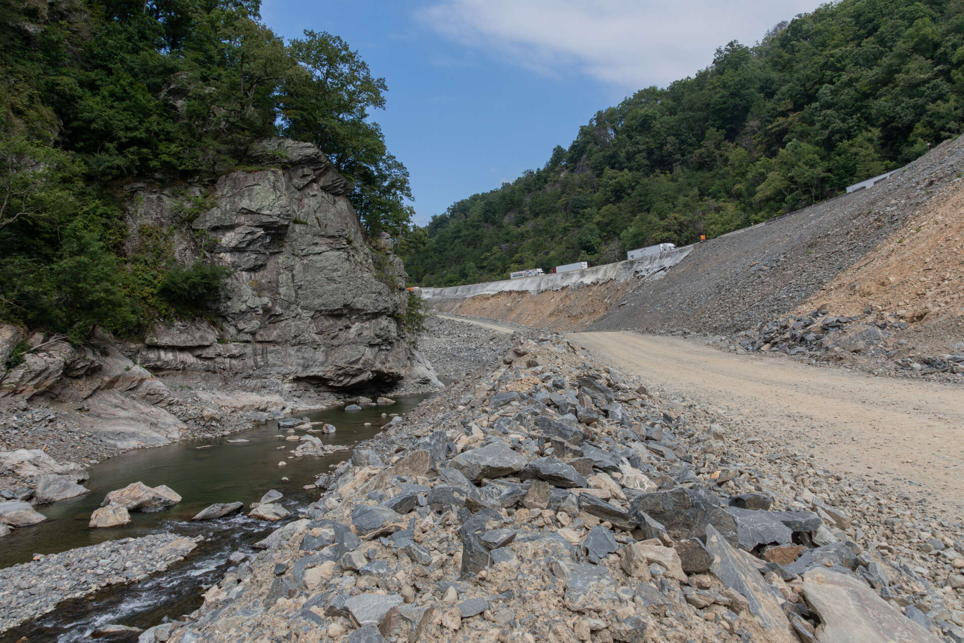
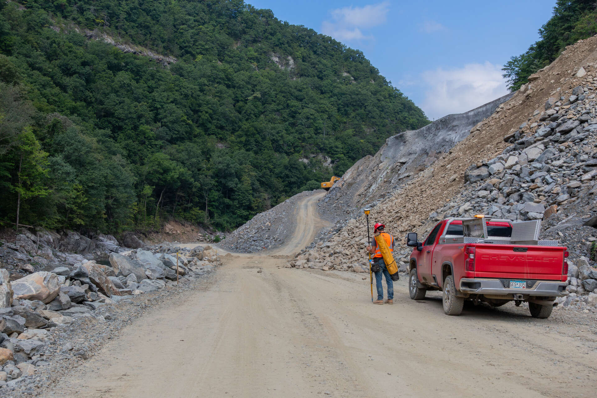
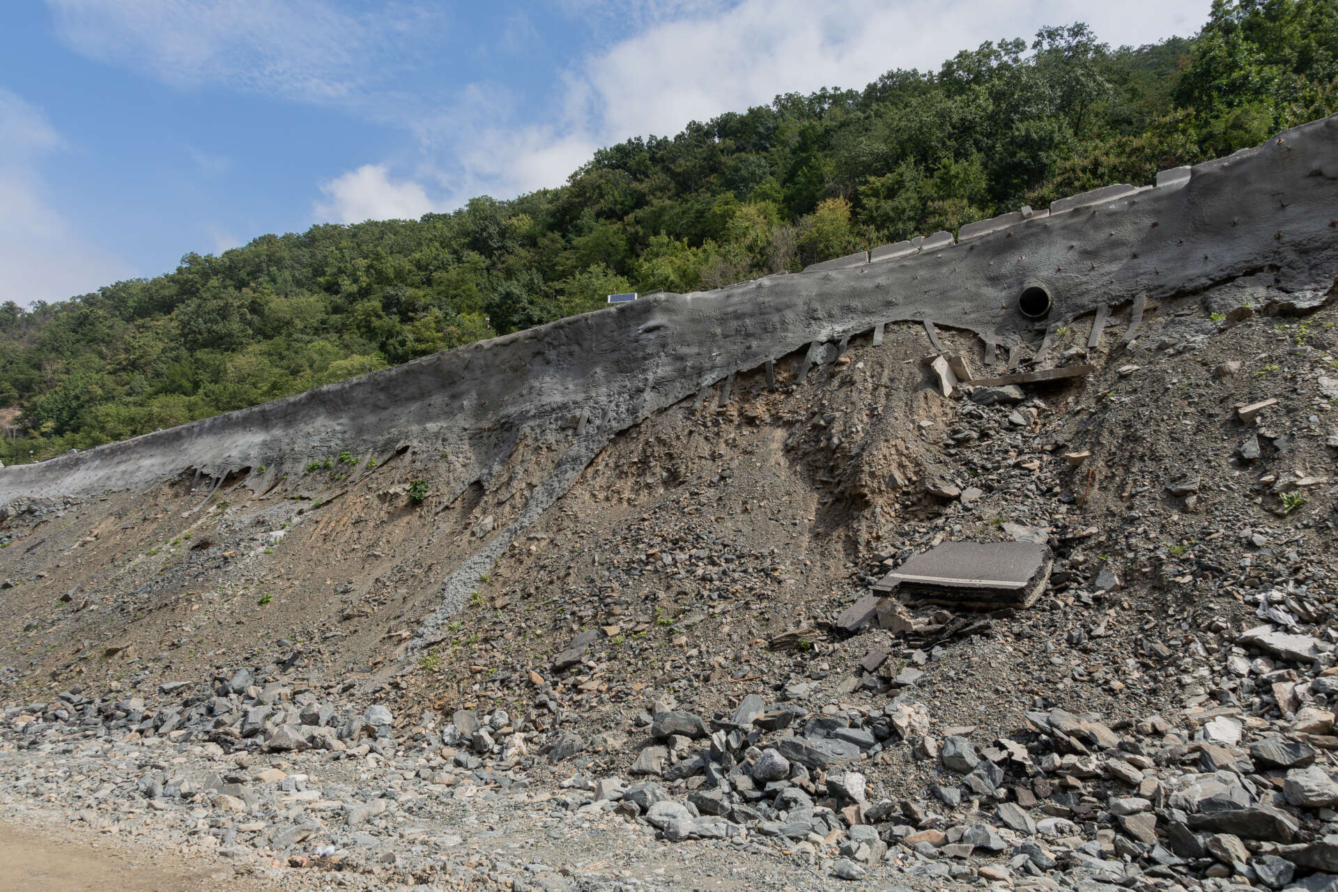
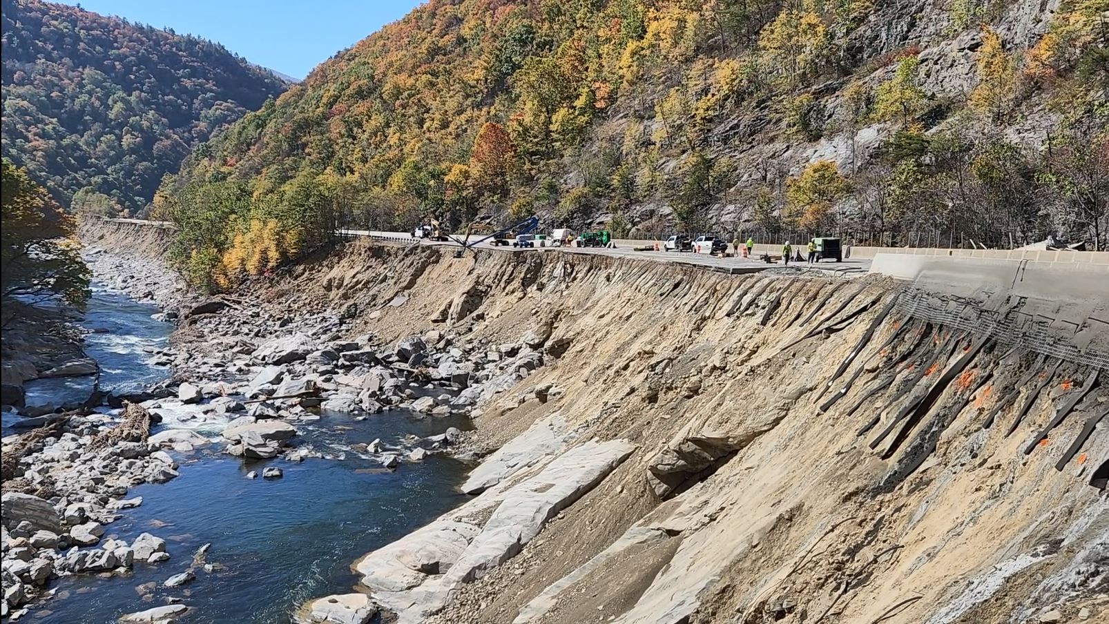
Following the destructive impact of Hurricane Helene, a critical section of I-40 through the Pigeon River Gorge sustained extensive damage, including major slope failures, culvert blowouts, and pavement loss due to high-velocity floodwaters and debris flows. This corridor serves as a vital transportation link between western North Carolina and eastern Tennessee, making immediate recovery a top priority for NCDOT and its partners.
RK&K was selected by NCDOT to lead emergency repair design services, including roadway design, environmental permitting and compliance, geotechnical analysis, drainage reconstruction, and traffic control. What sets this project apart is the simultaneous progression of design and construction—a dynamic emergency response effort requiring real-time coordination between engineers, contractors, and environmental compliance teams.
Given the project’s location within a highly sensitive and complex regulatory environment, environmental compliance has remained a central pillar of RK&K’s role. The project footprint includes U.S. Forest Service (USFS) property, requiring adherence to USFS land requirements, specialized biological surveys, and coordination with federal regulators to develop permits and environmental compliance plan. In parallel, adjacent infrastructure and drainage impacts involve a federally regulated hydroelectric power facility, necessitating communication and compliance with operational requirements, access restrictions, and potential flow-release coordination with the facility operator.
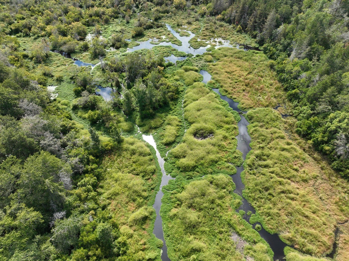
The GIS team was tasked with collecting and providing useful geospatial information to the project team. Among these efforts was to host the Pigeon River web application that could include an evolving level of data to allow for easy sharing and collaboration. Among the innovative products produced from the GIS/UAS analysis was a deposition heatmap. The UAS collected lidar surface was compared to the 2017 statewide lidar which revealed there was 864k cubic feet of material in the river channel that was not there in 2017. A pixel-by-pixel calculation generated a heatmap showing the depth of depositions throughout the river channel.
Following the destructive impact of Hurricane Helene, a critical section of I-40 through the Pigeon River Gorge sustained extensive damage, including major slope failures, culvert blowouts, and pavement loss due to high-velocity floodwaters and debris flows. This corridor serves as a vital transportation link between western North Carolina and eastern Tennessee, making immediate recovery a top priority for NCDOT and its partners.
RK&K was selected by NCDOT to lead emergency repair design services, including roadway design, environmental permitting and compliance, geotechnical analysis, drainage reconstruction, and traffic control. What sets this project apart is the simultaneous progression of design and construction—a dynamic emergency response effort requiring real-time coordination between engineers, contractors, and environmental compliance teams.
Given the project’s location within a highly sensitive and complex regulatory environment, environmental compliance has remained a central pillar of RK&K’s role. The project footprint includes U.S. Forest Service (USFS) property, requiring adherence to USFS land requirements, specialized biological surveys, and coordination with federal regulators to develop permits and environmental compliance plan. In parallel, adjacent infrastructure and drainage impacts involve a federally regulated hydroelectric power facility, necessitating communication and compliance with operational requirements, access restrictions, and potential flow-release coordination with the facility operator.
The GIS team was tasked with collecting and providing useful geospatial information to the project team. Among these efforts was to host the Pigeon River web application that could include an evolving level of data to allow for easy sharing and collaboration. Among the innovative products produced from the GIS/UAS analysis was a deposition heatmap. The UAS collected lidar surface was compared to the 2017 statewide lidar which revealed there was 864k cubic feet of material in the river channel that was not there in 2017. A pixel-by-pixel calculation generated a heatmap showing the depth of depositions throughout the river channel.
You might also be interested in:
Blog
Gordon Marsh, STP, PWS
Building Resilience by Protecting Wetlands Across North Carolina